Our Equipment
Precision begins with the right tools. Akriveia Surveying uses advanced GNSS, LiDAR, and aerial imaging technology to ensure accurate results in every project—from topographic mapping to 3D modeling.
DJI Zenmuse L2
Zenmuse L2 offers real-time 3D data capture with centimeter-level accuracy, ideal for high-precision aerial LiDAR scanning. Learn more on the DJI official site.
DJI Terra
DJI Terra transforms drone data into digital assets for 3D reconstructions, maps, and site modeling. Explore its capabilities on the DJI Terra product page.
Hydrolite-DFX
Hydrolite-DFX is a rugged hydrographic surveying solution designed for water depth and bottom profiling. View technical specs at Seafloor Systems.
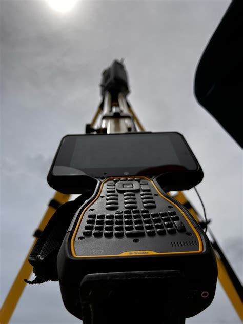
Trimble TSC7 Controller
Field-ready Windows controller with full keyboard, 7" touchscreen, and seamless GNSS integration. More on the Trimble Geospatial page.
Why Professionals Trust Akriveia Equipment
Accuracy begins with the right tools. We invest in cutting-edge surveying tech that boosts efficiency, accuracy, and field adaptability. Whether in urban centers or remote coasts, our equipment and team are ready for any challenge.
Equip Your Project with Confidence
Work with Akriveia’s expert team and best-in-class technology. Let’s bring your site to life.
Contact Us